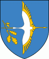
Stolin
 |
Stolin grew up at the heart of the Polesia region on the Haryn River, at the crossroads of two important routes, one leading northwards to Pinsk, two others eastwards to Davyd-Haradok and Turaŭ, that are now in Belarus, southwards to Sarny and Kyiv, that are now in Ukraine.
Archaeological evidence suggests that the area which Stolin now occupies, was settled as far back as the 12th century AD. The first mention of Stolin dates to 1555. There are three stories regarding the origins of the name "Stolin". The first refers to a group of local fisherman who cast their fishing nets into a lake a pulled out 100 fish or Sto [100 in Russian] "Leeni" [a type of local fish]. The second story refers to a ferry-boat which sunk in the river and required 100 men with 100 ropes to drag it out [100 lines in Russian]. The third refers to twelve brothers who ruled over seven nearby cities and chose what became Stolin as their meeting place and capital city, hence the name may be a derivation of stol (table)> Stolny Gorod (capital city).
Stolin was occupied by the Germans from July 1941 to 1944. In August 1941, many Jewish refugees – especially women and children – from the nearby town of David-Gorodok came to Stolin. A ghetto was created in May 1942, surrounded by a barbed-wire fence. About 7,000 Jews lived in this small and unhealthy area, along the Bank River. The liquidation of the ghetto was conducted on September 11, 1942, by a squadron of German cavalry, the local police and the SD. The shooting took place near the airfield, in a large ditch.
Map - Stolin
Map


Country - Belarus
 |
 |
| Flag of Belarus | |
Until the 20th century, different states at various times controlled the lands of modern-day Belarus, including Kievan Rus', the Principality of Polotsk, the Grand Duchy of Lithuania, the Polish–Lithuanian Commonwealth, and the Russian Empire. In the aftermath of the Russian Revolution in 1917, different states arose competing for legitimacy amid the Civil War, ultimately ending in the rise of the Byelorussian SSR, which became a founding constituent republic of the Soviet Union in 1922. After the Polish-Soviet War, Belarus lost almost half of its territory to Poland. Much of the borders of Belarus took their modern shape in 1939, when some lands of the Second Polish Republic were reintegrated into it after the Soviet invasion of Poland, and were finalized after World War II. During World War II, military operations devastated Belarus, which lost about a quarter of its population and half of its economic resources. The republic was redeveloped in the post-war years. In 1945, the Byelorussian SSR became a founding member of the United Nations, along with the Soviet Union.
Currency / Language
| ISO | Currency | Symbol | Significant figures |
|---|---|---|---|
| BYN | Belarusian ruble | Br | 2 |
| ISO | Language |
|---|---|
| BE | Belarusian language |
| RU | Russian language |